Seven Lakes Basin and High Divide
route details
TRAIL NAME: Seven Lakes Basin and High Divide
DATE: July 18, 2024
LENGTH: 21 miles, 5700 feet elevation gain
TRAILHEAD: Sol Duc Falls
FEES/PERMIT: All visitors to Olympic National Park (ONP) must pay applicable entry fees or display a valid interagency park pass. No permit is required to day hike this trail. Overnight hikers must obtain an ONP Wilderness Permit for stays between July 15 and October 15 (in 2024); visit Recreation.gov for more details and updated permit information.
DIFFICULTY: Hard
WATER: Multiple lake and stream sources are available throughout the trail to filter water. There is no water source between Seven Lakes Basin and Heart Lake.
RESTROOMS: Vault toilets at the trailhead, and backcountry privies at Deer Lake, Lunch Lake, Heart Lake, and Sol Duc Park. For solid human waste in all other locations, dig a cat hole 6-8” deep and at least 200 feet away from any campsite, trail, or water source.
TIPS: Bear canisters are required for all overnight stays in ONP. For current campfire restrictions, visit the National Park Service website.
trail notes
This stunning trail takes visitors through one of the premier hiking and backpacking destinations in Olympic National Park. Scenic waterfalls, old growth forests, meadows of wildflowers, serene alpine lakes, and stunning mountain views - this 20+ mile route really does have it all!
I originally intended to complete this trail as a 3 day/2 night backpacking trip, and secured campsites at Lunch Lake and Heart Lake the morning they became available in mid-March 2024. As the date of my July hike approached, however, trail reports consistently noted a serious concern: mosquitos. Lots and lots and lots of mosquitos. So many, in fact, that other hikers referenced dozens of bites, miserable hours huddled in tents, and the eventual need to literally “bug out” of their campsite to escape them. This is an experience I’ve unfortunately shared on previous backpacking treks, and I was not eager to repeat it. With a heavy heart, I ultimately decided to release my permits back into the reservation system, and take my chances on a long day hike instead. The following trip report details my adventures along this truly spectacular trail.
the hike
My parents (where I was based while visiting Washington over the summer) live a little over 2.5 hours from the trailhead, including (at the time) a significant construction detour off US Highway 101 west of Port Angeles). I wanted to start hiking not long after sunrise, and was on the road by 3am. The trailhead parking lot - which also serves the very popular Sol Duc Falls - was more than half full when I arrived, but very few hikers were milling about when I set off just before 6am.
The first 1/2 mile of the hike was an easy, relatively flat walk through the woods en route to Sol Duc Falls. Just before the falls, the path intersected with the well-marked loop trail for Seven Lakes Basin and High Divide. There were two options at this juncture: a clockwise route with a longer, more gradual ascent, or a counter-clockwise route with a shorter but steeper climb. I much prefer to go up steep sections than down them, and chose the latter option. A few short steps later, I found myself on a wooden footbridge over lovely Sol Duc Falls.
After the falls, the wooded trail began to climb, gaining roughly 1,500 feet over three miles en route to Deer Lake. I didn’t encounter any other hikers in this stretch, although I did pass a campsite in use at Canyon Creek, with backpackers (likely) asleep in their tents.
Deer Lake was still and silent as I hiked through around half past seven. As I continued past the lake, I began to meet other hikers, including several bleary-eyed backpackers “bugging out”, who confirmed the presence of ravenous mosquitos further up the trail.
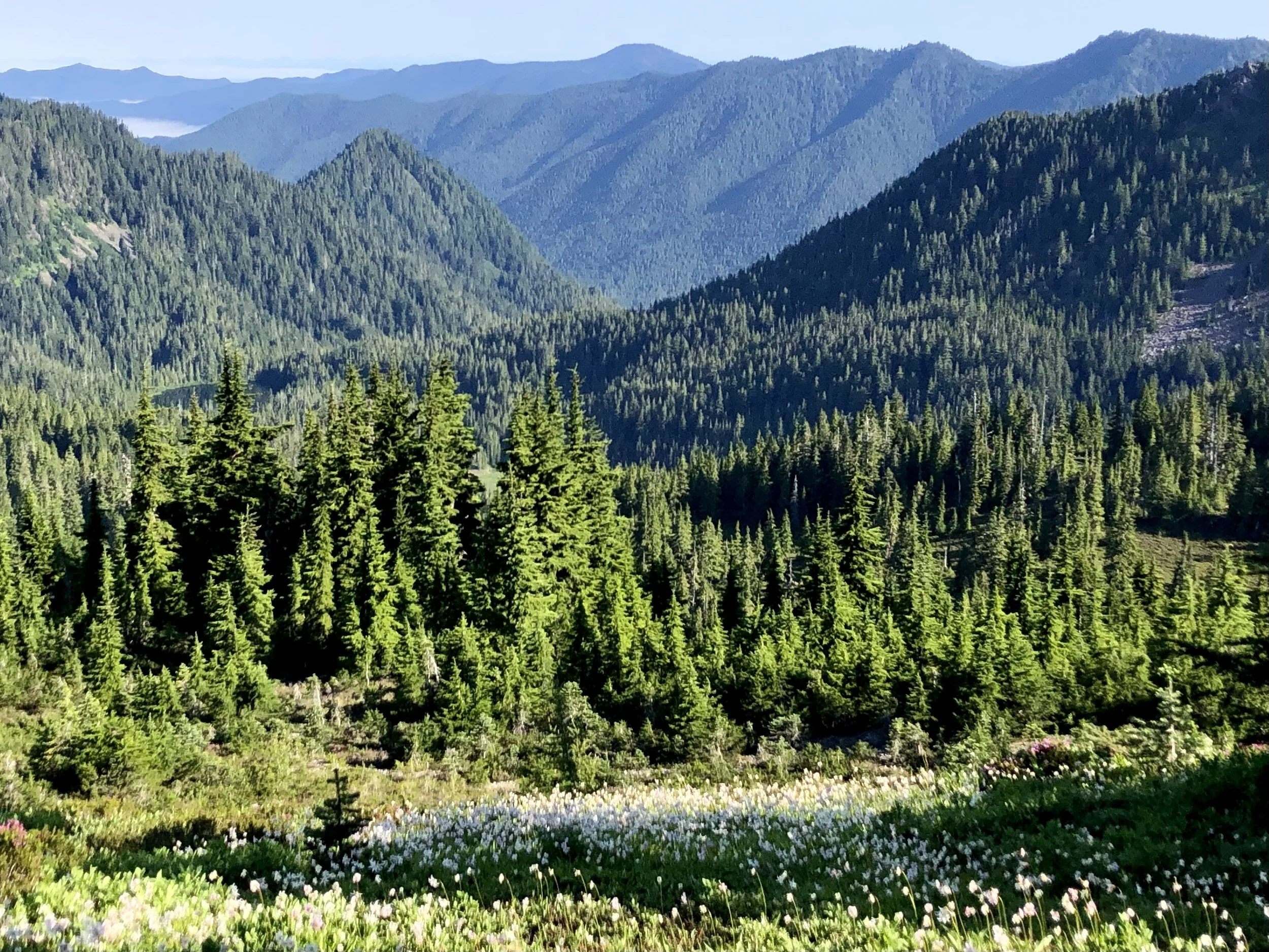
Half a mile from Deer Lake, the trail entered a series of pink heather meadows studded with tarns and thick groves of mountain hemlock. The path climbed steadily here over several switchbacks on its way to the top of a ridgeline.
After cresting the ridge, the trail dropped slightly and continued along its other side, through hillside meadows strewn with Columbia tiger lilies, scarlet paintbrush, rosy spiraea, woodland beardtongue, phlox, bistort, Sitka columbine and valerian, goatsbeard, penstemon, avalanche lilies, lupine, Columbia lewisia, broadleaf arnica - and lots and lots of buzzing, happy bees!
Approximately six miles from the trailhead, I found myself at the (very faded) trail junction sign for Seven Lakes Basin. As I set out that morning, I hadn’t yet decided if I’d make the detour into the basin - it’s a rapid drop and gain of 500 feet, and the reports of mosquitos there sounded particularly daunting - but I ultimately decided to make the most of this possibly once-in-a-lifetime opportunity to see it.
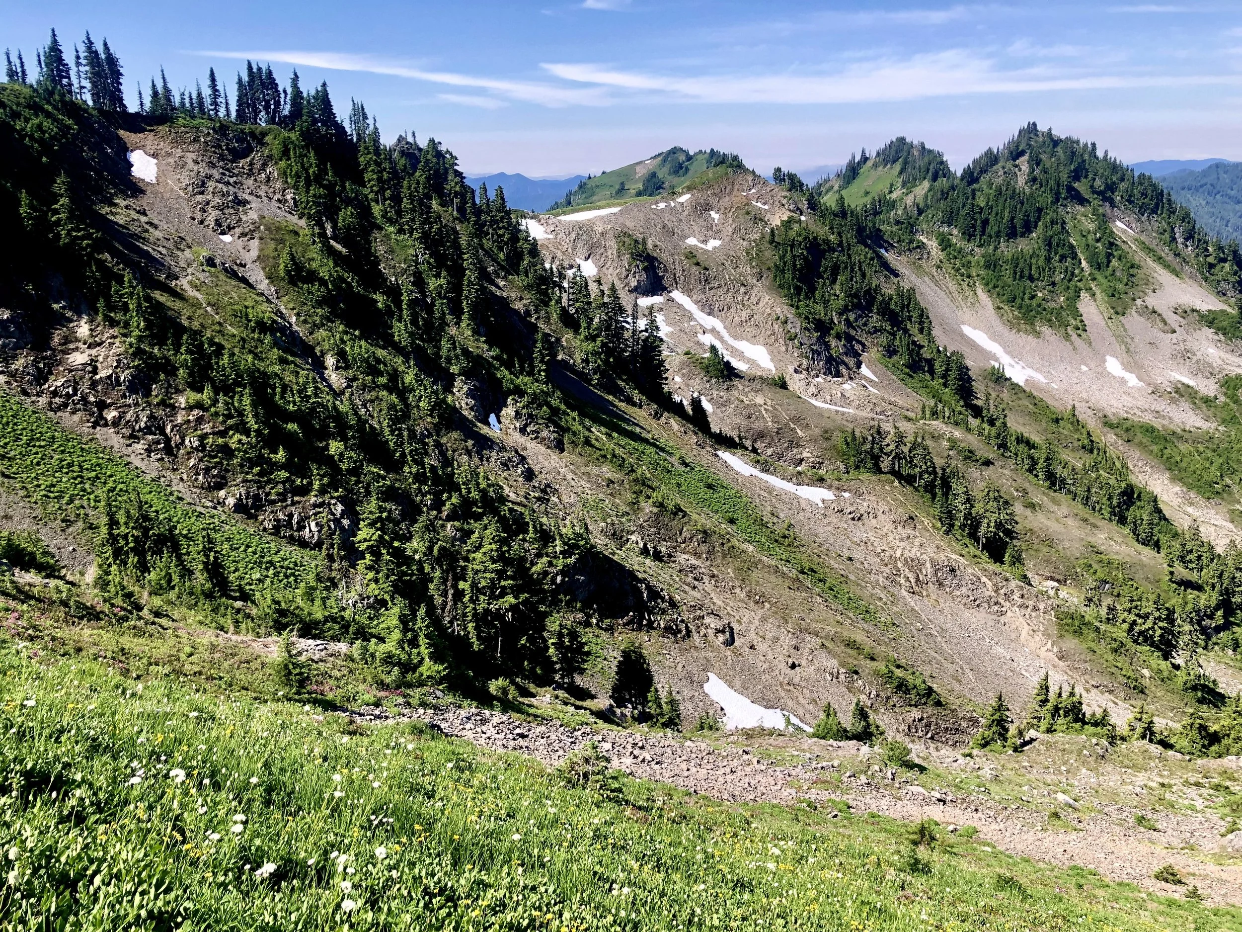
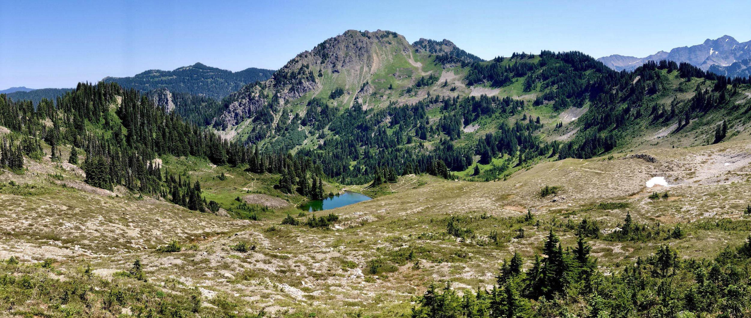
The trail passes briefly through the rocky area pictured below, before cresting the ridge and rapidly descending into the basin. The views were spectacular from the outset, and I immediately spotted Round Lake and Lunch Lake (where I’d once intended to camp that evening) below. What I saw before me was truly breathtaking: crystal clear lakes sparkling in the summer sunshine, emerald green meadows brimming with wildflowers and bubbling streams, and miles of forest in all directions to wander through and explore. It was the perfect habitat for black bears, deer, and marmots, but alas, I didn’t spot any, despite my best efforts.
Indeed, as I arrived on the pretty shores of Lunch Lake, it became increasingly clear the only wildlife I was likely to encounter were a few skittish frogs and hundreds upon hundreds of mosquitos. Dear god, the SWARMS. I could scarcely stop to take a photo without being inundated by the most voracious and aggressive little buggers I’d ever seen. The backpackers I ran into here were desperately packing up their gear and fleeing, all describing a previous evening of itchy misery as they attempted to escape the buzzing hordes. Yikes!
After departing Lunch (without a moment’s opportunity to stop and eat mine), I hiked a short distance to Round Lake. The wildflowers were beautiful and abundant along its shores, and it offered more solitude and tranquility than its predecessor. From people, that is. The mosquitos were just as awful there, and - after ten minutes of fruitlessly trying to evade them - I dashed away as quickly as I could.
The gorgeous views in the basin were well worth my climb in and out on a day hike, but I’m so happy I decided against camping here, given the buggy conditions on my permit date!
After emerging from the basin around 10:30am, I continued on the main trail toward High Divide and Heart Lake.
The trail skirted the southern edge of a ridgeline for roughly one mile before reaching a junction with the route to Hoh Lake (which I skipped).
A short distance beyond the Hoh Lake trail junction, a short spur trail switchbacked up to the summit of Bogachiel Peak. I scrambled up it, with hopes the views would be epic, and that a breeze might mitigate the impact of the bugs. I was right on the former, but dead wrong on the latter - somehow the mosquitos were actually worse at the peak than down in the basin - and I quickly hurried back to the main trail to escape them.
For the next 2.5 miles, the path followed High Divide, a scenic ridge separating the Hoh River valley and Sol Duc River valley. The views from the divide are jaw-dropping in all directions; Mount Olympus - the tallest peak in the Olympics - looms unobstructed to the south, while the entirety of Seven Lakes Basin is finally visible to the north. The trail itself was also lovely, passing through lush green meadows speckled with bistort, avalanche lilies, lupine, tiger lilies, and something (maybe phlox?) that left a sweet fragrance in the air. I quickly came to realize why so many hikers wax poetic about this segment of the trail in particular - what a feast for the senses!
Heart Lake - the second campsite I’d selected and eventually relinquished on my now-abandoned backpacking adventure - came into view just before the main trail intersected with the route to Cat Basin (and eventually the Bailey Traverse).
I dropped down to the aptly named lake but didn’t remain for long. I would have liked to stay and explore, but unfortunately the mosquitos continued their relentless assault. I even had to eat on the move, lest I be eaten alive myself, but I would very much like to return some day (maybe with Aleks?) to see and do more here.
The trail from Heart Lake back to Sol Duc Falls was roughly 6.5 miles, all downhill. It passed through multiple designated camping areas, including Sol Duc Park (very pretty), Lower Bridge Creek, Sol Duc Crossing, Appleton Junction, and four sites scattered along the banks of the Sol Duc River.
Most of the descent back to the falls travelled through forest, and I stopped often in the last two miles to pick mountain blueberries, a favorite treat of my mom’s.
I ran into dozens of hikers making the short jaunt to Sol Duc Falls in the final minutes of my journey, and arrived back at the trailhead a few minutes before 4pm.
Twenty one miles of hiking with over 5,700 feet of gain, in less than 10 hours - not bad, and I even made it home in time to tuck Aleks into bed for the night!
final thoughts
This beautiful trail to Seven Lakes Basin and High Divide truly lived up to its awesome reputation, and in spite of the mosquitos, I really loved this day hike. There were sections I was certainly happy not to be wearing a heavier pack, but the opportunity to set up camp and explore the area more deeply may just make the challenge worth it. I hope to be back in the (near) future, doing just that.


